Greenwich Cemetery, Eltham SE9
Introduction
The photograph on this page of Greenwich Cemetery, Eltham SE9 by David Hallam-Jones as part of the Geograph project.
The Geograph project started in 2005 with the aim of publishing, organising and preserving representative images for every square kilometre of Great Britain, Ireland and the Isle of Man.

There are currently over 7.5m images from over 14,400 individuals and you can help contribute to the project by visiting https://www.geograph.org.uk
Greenwich Cemetery, Eltham SE9
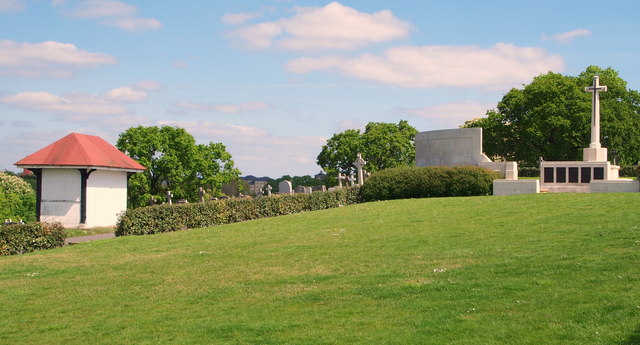
Image: © David Hallam-Jones Taken: 3 May 2014
This picture shows how some of the land on this 9.2 hectare/24 acre site slopes down from its flatter portion (perhaps 50% of it) nearer the Dunblane Road side of the site towards the residential street known as Mayday Gardens. The war memorial cross is one of the central features of the cemetery with two commemorative marble screens and in addition, one of the half-a-dozen (now boarded up) weather-protection shelters is also seen here.
Images are licensed for reuse under creativecommons.org/licenses/by-sa/2.0
Image Location
Latitude
51.465722
Longitude
0.046878