Greenwich Cemetery, Eltham SE9
Introduction
The photograph on this page of Greenwich Cemetery, Eltham SE9 by David Hallam-Jones as part of the Geograph project.
The Geograph project started in 2005 with the aim of publishing, organising and preserving representative images for every square kilometre of Great Britain, Ireland and the Isle of Man.

There are currently over 7.5m images from over 14,400 individuals and you can help contribute to the project by visiting https://www.geograph.org.uk
Greenwich Cemetery, Eltham SE9
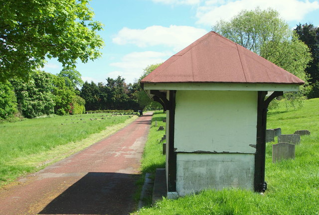
Image: © David Hallam-Jones Taken: 3 May 2014
A view towards the entrance on Well Hall Road, a 10 minute walk straight ahead. Langbrook Road lies a 5 minute walk away behind the photographer, although there is no access out into it. Mayday Gardens - a residential street - is situated behind the tree line on the left. This Victorian cemetery is one of the largest cemeteries in London being of approximately 9.5 hectares in size (or 24 acres) and, as this picture reveals, a considerable amount of spare capacity remains available. One of half-a-dozen weather-protection shelters is seen here although all but the one nearest the entrance to the cemetery is boarded up as an anti- misbehaviour strategy.
Images are licensed for reuse under creativecommons.org/licenses/by-sa/2.0
Image Location
Latitude
51.466797
Longitude
0.04707