Parkside Farm, Lydiard Millicent
Introduction
The photograph on this page of Parkside Farm, Lydiard Millicent by Vieve Forward as part of the Geograph project.
The Geograph project started in 2005 with the aim of publishing, organising and preserving representative images for every square kilometre of Great Britain, Ireland and the Isle of Man.

There are currently over 7.5m images from over 14,400 individuals and you can help contribute to the project by visiting https://www.geograph.org.uk
Parkside Farm, Lydiard Millicent
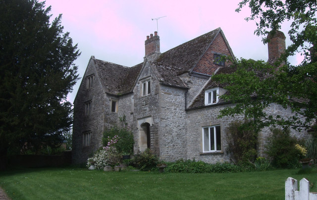
Image: © Vieve Forward Taken: 7 May 2014
Grade II Listed 16th century stone-tiled Cotswold stone farmhouse. http://www.britishlistedbuildings.co.uk/en-317878-parkside-farmhouse-lydiard-millicent- Originally built on an 'E' plan, the structure to the right of central porch was replaced in the 18th century by a single storey with attic service rooms. The 2-storey porch is gabled, with a 2-light stone-mullioned window and an open doorway over a flight of steps. It has a moulded segmental arch. The arms and supporters over the door are said to date from 1581. The left wing is gabled, with 2- and 3-light stone-mullioned windows. The structure to the right of the porch has a hipped roof and was extended to the rear as a dairy. There are two brick chimney stacks.
Images are licensed for reuse under creativecommons.org/licenses/by-sa/2.0
Image Location
Latitude
51.567214
Longitude
-1.86318