Taunton: a new scoreboard at The County Ground
Introduction
The photograph on this page of Taunton: a new scoreboard at The County Ground by John Sutton as part of the Geograph project.
The Geograph project started in 2005 with the aim of publishing, organising and preserving representative images for every square kilometre of Great Britain, Ireland and the Isle of Man.

There are currently over 7.5m images from over 14,400 individuals and you can help contribute to the project by visiting https://www.geograph.org.uk
Taunton: a new scoreboard at The County Ground
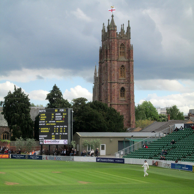
Image: © John Sutton Taken: 6 May 2014
A new, much clearer electronic scoreboard replaced the previous one at the start of the 2014 season - see Image] for an idea of the old one. Nottinghamshire had reached 80 for one near the end of the weather-shortened third day of a high-scoring match. In the background is St James's Church, with part of the equally tall tower of the church of St Mary Magdalene showing behind it.
Images are licensed for reuse under creativecommons.org/licenses/by-sa/2.0
Image Location


Leaflet Map data © OpenStreetMap
Latitude
51.018366
Longitude
-3.101555