Site of High Cross Gate
Introduction
The photograph on this page of Site of High Cross Gate by Simon Carey as part of the Geograph project.
The Geograph project started in 2005 with the aim of publishing, organising and preserving representative images for every square kilometre of Great Britain, Ireland and the Isle of Man.

There are currently over 7.5m images from over 14,400 individuals and you can help contribute to the project by visiting https://www.geograph.org.uk
Site of High Cross Gate
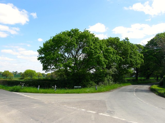
Image: © Simon Carey Taken: 3 May 2014
Located at the junction of Twineham Lane and Reeds Lane the area in front of the road sign was once the site of a tollhouse called High Cross Gate that charged road users for travel along the latter to the main London-Brighton turnpike which later became the A23. The tollhouse was marked on the 1874 OS map but the road was disturnpiked in 1876 and disappeared soon after. The OS map also has a small circular pond in front of the old building roughly where the dark triangular patch in the road is. To the immediate south out of shot is Image whilst the field beyond is Image
Images are licensed for reuse under creativecommons.org/licenses/by-sa/2.0
Image Location
Latitude
50.942943
Longitude
-0.221722