Coombe Trenchard viewed from the Croquet Lawn
Introduction
The photograph on this page of Coombe Trenchard viewed from the Croquet Lawn by Rod Allday as part of the Geograph project.
The Geograph project started in 2005 with the aim of publishing, organising and preserving representative images for every square kilometre of Great Britain, Ireland and the Isle of Man.

There are currently over 7.5m images from over 14,400 individuals and you can help contribute to the project by visiting https://www.geograph.org.uk
Coombe Trenchard viewed from the Croquet Lawn
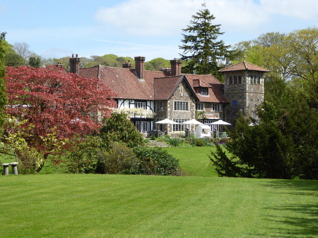
Image: © Rod Allday Taken: 30 Apr 2014
A Grade II* Listed Edwardian manor in the Arts & Crafts style.
Images are licensed for reuse under creativecommons.org/licenses/by-sa/2.0
Image Location
Latitude
50.653608
Longitude
-4.195324