Freeman Street
Introduction
The photograph on this page of Freeman Street by David Wright as part of the Geograph project.
The Geograph project started in 2005 with the aim of publishing, organising and preserving representative images for every square kilometre of Great Britain, Ireland and the Isle of Man.

There are currently over 7.5m images from over 14,400 individuals and you can help contribute to the project by visiting https://www.geograph.org.uk
Freeman Street
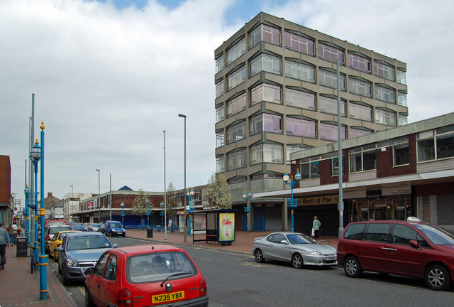
Image: © David Wright Taken: 6 Apr 2007
Photo taken looking North from a position near the corner of Albert Road West. The six-story block is very 1960's but is not mentioned in Pevsner. Note the strange proliferation of lamp posts - there are both blue and galvanised types and a number are just posts without lamps.
Images are licensed for reuse under creativecommons.org/licenses/by-sa/2.0
Image Location
Latitude
53.573317
Longitude
-0.073095