Former Paisley Infantry Barracks
Introduction
The photograph on this page of Former Paisley Infantry Barracks by Thomas Nugent as part of the Geograph project.
The Geograph project started in 2005 with the aim of publishing, organising and preserving representative images for every square kilometre of Great Britain, Ireland and the Isle of Man.

There are currently over 7.5m images from over 14,400 individuals and you can help contribute to the project by visiting https://www.geograph.org.uk
Former Paisley Infantry Barracks
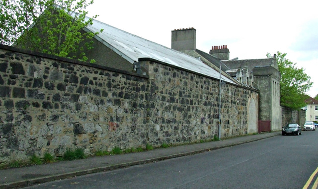
Image: © Thomas Nugent Taken: 5 May 2014
This photo shows the Whitehaugh Avenue side of some of the remaining barracks buildings. Canmore describes the building with the chimneys as follows, "Despite its 'antique' appearance, as an L-shaped tower house it seems that the hall, which bears an artillery crest, is of the interwar period. The actual hall, to the south of the 1930s building, seems to be an adaptation of a pre-existing building of the barracks".
Images are licensed for reuse under creativecommons.org/licenses/by-sa/2.0
Image Location
Latitude
55.847454
Longitude
-4.405406