Jerwoods, Vicarage Road, Oakham
Introduction
The photograph on this page of Jerwoods, Vicarage Road, Oakham by Richard Vince as part of the Geograph project.
The Geograph project started in 2005 with the aim of publishing, organising and preserving representative images for every square kilometre of Great Britain, Ireland and the Isle of Man.

There are currently over 7.5m images from over 14,400 individuals and you can help contribute to the project by visiting https://www.geograph.org.uk
Jerwoods, Vicarage Road, Oakham
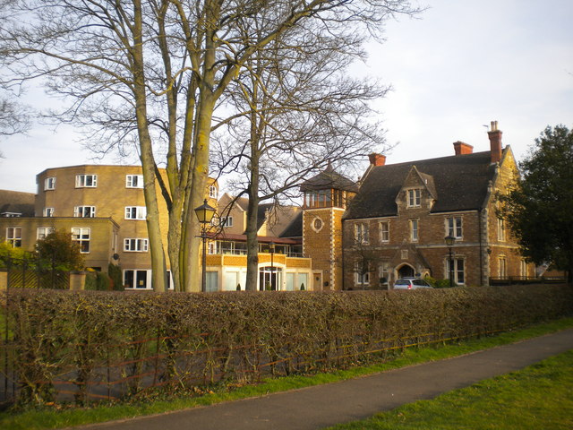
Image: © Richard Vince Taken: 8 Mar 2014
Jerwoods is the Lower School section of Oakham School, catering for pupils aged 10 to 13. It comprises the old vicarage (right, now the boys' boarding house) and a number of more recent buildings, dating mostly from the early 1970s. The round building (left, partly obscured by trees) is the girls' boarding house, while the remainder of the buildings contain classrooms.
Images are licensed for reuse under creativecommons.org/licenses/by-sa/2.0
Image Location
Latitude
52.672555
Longitude
-0.724104