
Binkleys Farm, Kirkgate, Silpho
Introduction
The photograph on this page of Binkleys Farm, Kirkgate, Silpho by Christopher Hall as part of the Geograph project.
The Geograph project started in 2005 with the aim of publishing, organising and preserving representative images for every square kilometre of Great Britain, Ireland and the Isle of Man.

There are currently over 7.5m images from over 14,400 individuals and you can help contribute to the project by visiting https://www.geograph.org.uk
Binkleys Farm, Kirkgate, Silpho
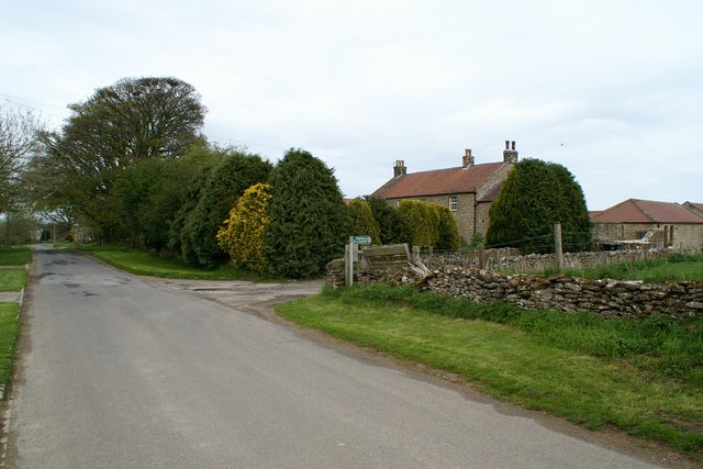
Image: © Christopher Hall Taken: 4 May 2014
Binkleys Farm is an early 19th century farmhouse with a courtyard behind built in the local coursed rubble under a clay pantile roof. The green finger post marks the start of a public footpath which runs across fields and then does a right angled turn to drop down to Hackness.
Images are licensed for reuse under creativecommons.org/licenses/by-sa/2.0
Image Location

Latitude
54.313754
Longitude
-0.517534