Water Main joint
Introduction
The photograph on this page of Water Main joint by Ian Capper as part of the Geograph project.
The Geograph project started in 2005 with the aim of publishing, organising and preserving representative images for every square kilometre of Great Britain, Ireland and the Isle of Man.

There are currently over 7.5m images from over 14,400 individuals and you can help contribute to the project by visiting https://www.geograph.org.uk
Water Main joint
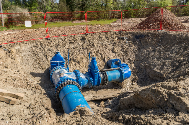
Image: © Ian Capper Taken: 18 Apr 2014
During 2013/early 2014, Sutton and East Surrey Water have been undertaking a major project to lay a new 32" water main from Outwood to Buckland. Here is a close up of the joint in Image
Images are licensed for reuse under creativecommons.org/licenses/by-sa/2.0
Image Location


Leaflet Map data © OpenStreetMap
Latitude
51.244479
Longitude
-0.258258