Barrier across a cycle route and footpath, Nant-y-Bwch, Tredegar
Introduction
The photograph on this page of Barrier across a cycle route and footpath, Nant-y-Bwch, Tredegar by Jaggery as part of the Geograph project.
The Geograph project started in 2005 with the aim of publishing, organising and preserving representative images for every square kilometre of Great Britain, Ireland and the Isle of Man.

There are currently over 7.5m images from over 14,400 individuals and you can help contribute to the project by visiting https://www.geograph.org.uk
Barrier across a cycle route and footpath, Nant-y-Bwch, Tredegar
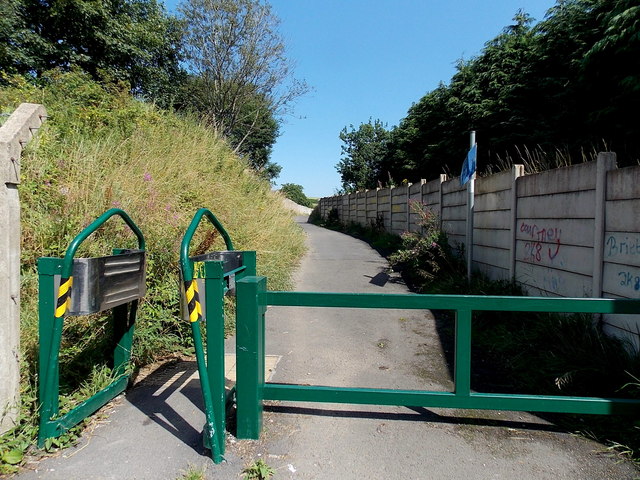
Image: © Jaggery Taken: 22 Aug 2013
The barrier on the east side of Llwyn Helyg prevents vehicular misuse of this footpath and cycleway. The blue sign alongside the wall shows that this is part of National Cycle Network route 46. Along this route it's 3 miles to Ebbw Vale, 5 to Brynmawr and 12 to Abergavenny.
Images are licensed for reuse under creativecommons.org/licenses/by-sa/2.0
Image Location
Latitude
51.789802
Longitude
-3.261183