
Trefasser Cross
Introduction
The photograph on this page of Trefasser Cross by Natasha Ceridwen de Chroustchoff as part of the Geograph project.
The Geograph project started in 2005 with the aim of publishing, organising and preserving representative images for every square kilometre of Great Britain, Ireland and the Isle of Man.

There are currently over 7.5m images from over 14,400 individuals and you can help contribute to the project by visiting https://www.geograph.org.uk
Trefasser Cross
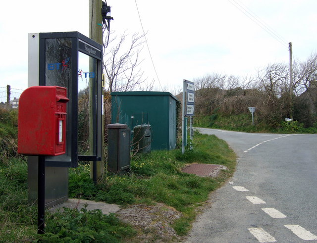
Image: © Natasha Ceridwen de Chroustchoff Taken: 9 Apr 2007
In the sparsely settled areas of Pembrokeshire the points where roads meet have considerable significance and account for the frequency of places called Something Cross. In this case the crossroads serves as a location for a letterbox, a public telephone, a bus stop and several telephone/electricity masts and junction boxes, as well as direction signs. Trefasser is no more than a cluster of houses but was supposedly named for its famous son, St Asser, a C9 monk who acted as scribe and biographer to King Alfred. There is an earthwork, Castell Poeth, behind the hedge; the bulk of Garn Fawr looms beyond.
Images are licensed for reuse under creativecommons.org/licenses/by-sa/2.0
Image Location

Latitude
51.9969
Longitude
-5.065385