Cambret Farm view to Cairnharrow
Introduction
The photograph on this page of Cambret Farm view to Cairnharrow by Andy Farrington as part of the Geograph project.
The Geograph project started in 2005 with the aim of publishing, organising and preserving representative images for every square kilometre of Great Britain, Ireland and the Isle of Man.

There are currently over 7.5m images from over 14,400 individuals and you can help contribute to the project by visiting https://www.geograph.org.uk
Cambret Farm view to Cairnharrow
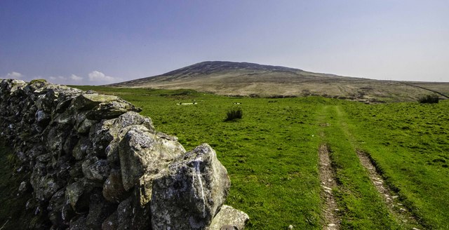
Image: © Andy Farrington Taken: 29 Apr 2014
Farm tracks take the eyes through the moors and across to the hill at Cairnharrow on the horizon. I was on the top of the hill two years ago at the trig point, which is at the 456 metre mark, and the weather conditions all day on the moors and hills were a combination of misle and rain with poor visibility, making it difficult Geographing the views and vistas. Today, the view was quite different from the farm, with blue skies and few clouds, showing me the importance of returning to places again and again.
Images are licensed for reuse under creativecommons.org/licenses/by-sa/2.0
Image Location
Latitude
54.882756
Longitude
-4.31607