Neist Lighthouse
Introduction
The photograph on this page of Neist Lighthouse by John Allan as part of the Geograph project.
The Geograph project started in 2005 with the aim of publishing, organising and preserving representative images for every square kilometre of Great Britain, Ireland and the Isle of Man.

There are currently over 7.5m images from over 14,400 individuals and you can help contribute to the project by visiting https://www.geograph.org.uk
Neist Lighthouse
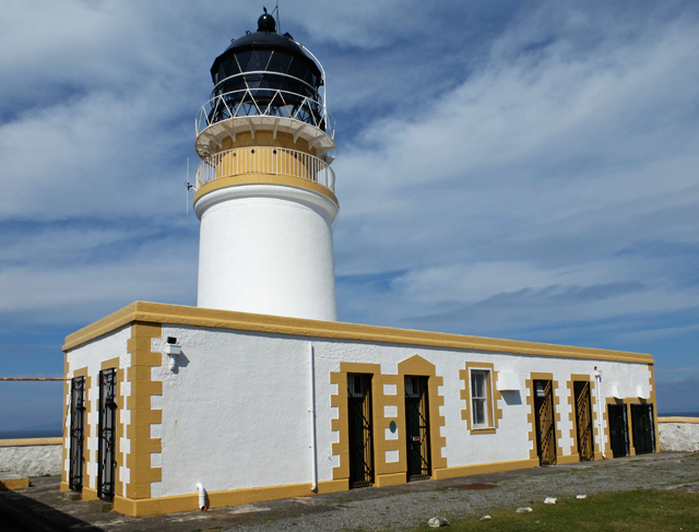
Image: © John Allan Taken: 23 Apr 2014
The fences and gates that surrounded the lighthouse compound have been breached recently, allowing closer public access than before. The main building seen here, and the tower behind it, have been freshly painted - presumably by the Northern Lighthouse Board. The surrounding buildings, once used as holiday cottages, are now derelict and decaying.
Images are licensed for reuse under creativecommons.org/licenses/by-sa/2.0
Image Location


Leaflet Map data © OpenStreetMap
Latitude
57.423432
Longitude
-6.788365