Dividing the land
Introduction
The photograph on this page of Dividing the land by Neil Owen as part of the Geograph project.
The Geograph project started in 2005 with the aim of publishing, organising and preserving representative images for every square kilometre of Great Britain, Ireland and the Isle of Man.

There are currently over 7.5m images from over 14,400 individuals and you can help contribute to the project by visiting https://www.geograph.org.uk
Dividing the land
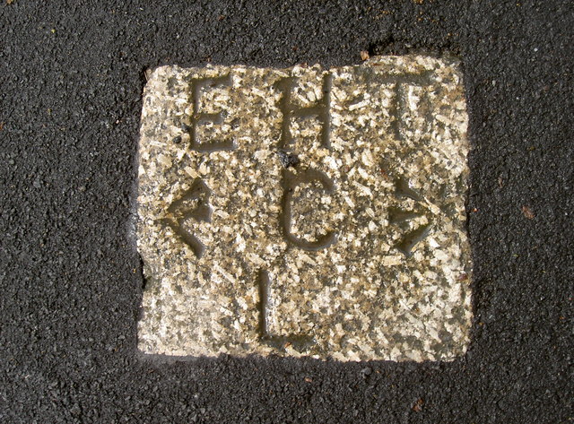
Image: © Neil Owen Taken: 28 Apr 2014
A boundary marker stone, set into the pavement in Winterstoke Road. It must be of some importance as it seems to be made of granite; the City, Parliamentary, County and Municipal boundary was long-established but was moved in the twentieth century. This lower end of the road wasn't metalled until after WWI, but the marker has been spared resurfacing. See Image] for a broader view.
Images are licensed for reuse under creativecommons.org/licenses/by-sa/2.0
Image Location
Latitude
51.436533
Longitude
-2.62043