Tudor Cottage, Surley Row
Introduction
The photograph on this page of Tudor Cottage, Surley Row by Rose and Trev Clough as part of the Geograph project.
The Geograph project started in 2005 with the aim of publishing, organising and preserving representative images for every square kilometre of Great Britain, Ireland and the Isle of Man.

There are currently over 7.5m images from over 14,400 individuals and you can help contribute to the project by visiting https://www.geograph.org.uk
Tudor Cottage, Surley Row
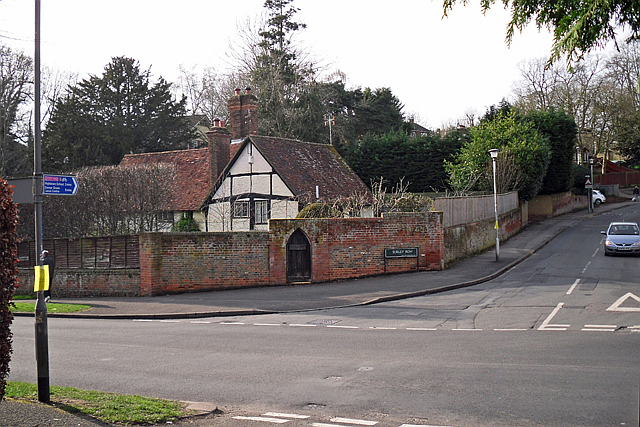
Image: © Rose and Trev Clough Taken: 5 Mar 2014
Viewed across Rotherfield Way, which for most of the cottage's life was just a footpath. The road was extended from Caversham to Emmer Green around the late 1960s, forming a crossroads with Surley Row which heads uphill to the right. Surley Row is a conservation area - see Reading Borough Council appraisal http://www.reading.gov.uk/documents%5Cservingyou%5Cplanning%5CConservation_Areas/19602/Surley-Row-Conservation-Area-Appraisal-0910.pdf ). Tudor Cottage is a timber framed building dating from the 16th century (http://www.imagesofengland.org.uk/Details/Default.aspx?id=39195 ).
Images are licensed for reuse under creativecommons.org/licenses/by-sa/2.0
Image Location
Latitude
51.478619
Longitude
-0.970669