Crookston Castle
Introduction
The photograph on this page of Crookston Castle by Lairich Rig as part of the Geograph project.
The Geograph project started in 2005 with the aim of publishing, organising and preserving representative images for every square kilometre of Great Britain, Ireland and the Isle of Man.

There are currently over 7.5m images from over 14,400 individuals and you can help contribute to the project by visiting https://www.geograph.org.uk
Crookston Castle
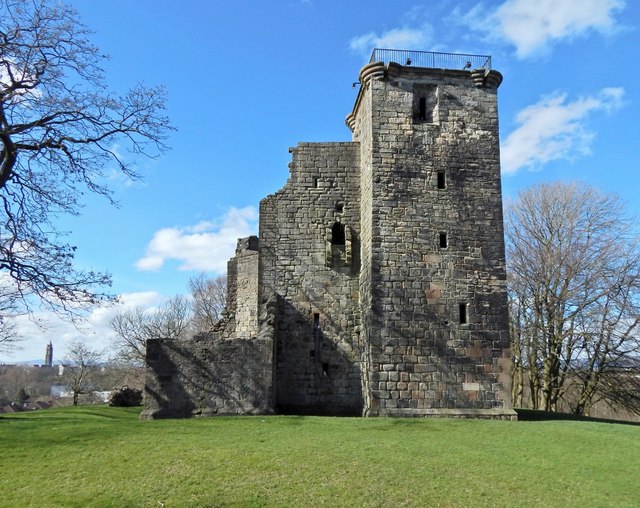
Image: © Lairich Rig Taken: 24 Mar 2014
The north-eastern tower is on the right, with its fenced-off rooftop: Image On the left are the remains of the south-eastern tower; when this was intact, the castle would have had a more symmetrical appearance. For the intact north-east tower, see also Image Click on the end-note title for related pictures. The Image is in the left background.
Images are licensed for reuse under creativecommons.org/licenses/by-sa/2.0
Image Location
Latitude
55.835109
Longitude
-4.355933