The line to Ross and Hereford
Introduction
The photograph on this page of The line to Ross and Hereford by John Winder as part of the Geograph project.
The Geograph project started in 2005 with the aim of publishing, organising and preserving representative images for every square kilometre of Great Britain, Ireland and the Isle of Man.

There are currently over 7.5m images from over 14,400 individuals and you can help contribute to the project by visiting https://www.geograph.org.uk
The line to Ross and Hereford
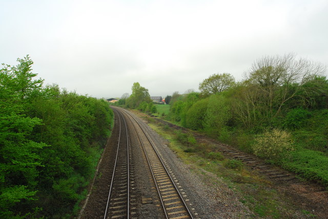
Image: © John Winder Taken: 24 Apr 2014
The site of Grange Court Junction. The railway line to Ross on Wye and Hereford ran through the grassy area beyond the gap in the trees in the centre of the photo. The remains of the goods loop can be seen on the right of the shot.
Images are licensed for reuse under creativecommons.org/licenses/by-sa/2.0
Image Location


Leaflet Map data © OpenStreetMap
Latitude
51.842364
Longitude
-2.402169