Larne Rural District Council fire hydrant post, Trooperslane, Carrickfergus
Introduction
The photograph on this page of Larne Rural District Council fire hydrant post, Trooperslane, Carrickfergus by Albert Bridge as part of the Geograph project.
The Geograph project started in 2005 with the aim of publishing, organising and preserving representative images for every square kilometre of Great Britain, Ireland and the Isle of Man.

There are currently over 7.5m images from over 14,400 individuals and you can help contribute to the project by visiting https://www.geograph.org.uk
Larne Rural District Council fire hydrant post, Trooperslane, Carrickfergus
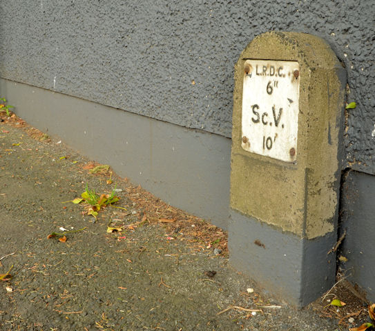
Image: © Albert Bridge Taken: 22 Apr 2014
A post marking a section control valve, on the Trooperslane Road, near the Old Shore Road – a survivor from before the reorganisation of local government in 1973. The initials “LRDC” mean “Larne Rural District Council” which administered a wider area than just the immediate environs of Larne town. See also Image
Images are licensed for reuse under creativecommons.org/licenses/by-sa/2.0
Image Location
Latitude
54.706036
Longitude
-5.842302