Victorian wall box (BT38 286) near Whitehead (1)
Introduction
The photograph on this page of Victorian wall box (BT38 286) near Whitehead (1) by Albert Bridge as part of the Geograph project.
The Geograph project started in 2005 with the aim of publishing, organising and preserving representative images for every square kilometre of Great Britain, Ireland and the Isle of Man.

There are currently over 7.5m images from over 14,400 individuals and you can help contribute to the project by visiting https://www.geograph.org.uk
Victorian wall box (BT38 286) near Whitehead (1)
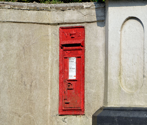
Image: © Albert Bridge Taken: 22 Apr 2014
A Victorian wall box on the Rawbrae Road, close to Quay Lane. I noted the number (BT38 286) at the time of the photograph and verified it by zooming in on the photograph. The official number is given, elsewhere, as BT38 337. Image shows the box in its geographical setting.
Images are licensed for reuse under creativecommons.org/licenses/by-sa/2.0
Image Location
Latitude
54.749527
Longitude
-5.729392