Woodside: High Road & Horseshoe Lane junction
Introduction
The photograph on this page of Woodside: High Road & Horseshoe Lane junction by Nigel Cox as part of the Geograph project.
The Geograph project started in 2005 with the aim of publishing, organising and preserving representative images for every square kilometre of Great Britain, Ireland and the Isle of Man.

There are currently over 7.5m images from over 14,400 individuals and you can help contribute to the project by visiting https://www.geograph.org.uk
Woodside: High Road & Horseshoe Lane junction
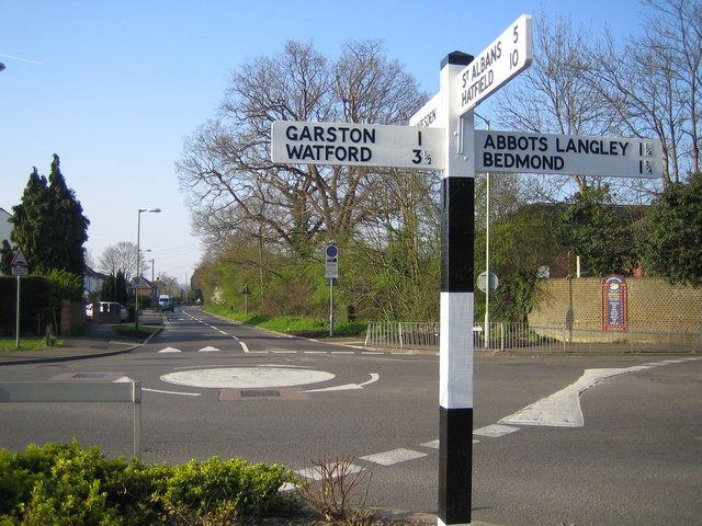
Image: © Nigel Cox Taken: 9 Apr 2007
This well cared-for old signpost stands at the centre of the universe apparently, on the north side of the junction of High Road (ahead), Horseshoe Lane (to the left), College Road (to the right), and Woodside Road (behind). The far board points to Leavesden ½. The photo shows one of the two mini-roundabouts here, the other one is to the right. The High Road here is the boundary between the Watford Borough Council area to the left and the Three Rivers District Council area to the right.
Images are licensed for reuse under creativecommons.org/licenses/by-sa/2.0
Image Location
Latitude
51.700495
Longitude
-0.403893