Gap between buildings, Warwick Terrace, Leamington
Introduction
The photograph on this page of Gap between buildings, Warwick Terrace, Leamington by Robin Stott as part of the Geograph project.
The Geograph project started in 2005 with the aim of publishing, organising and preserving representative images for every square kilometre of Great Britain, Ireland and the Isle of Man.

There are currently over 7.5m images from over 14,400 individuals and you can help contribute to the project by visiting https://www.geograph.org.uk
Gap between buildings, Warwick Terrace, Leamington
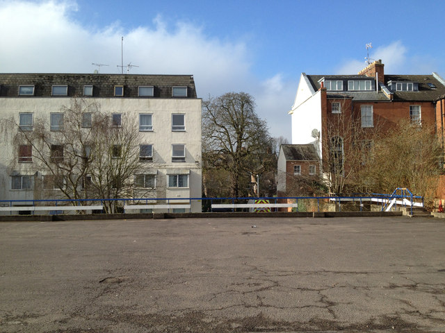
Image: © Robin Stott Taken: 17 Feb 2013
The view is roughly west across the private car park in Upper Grove Street. It would appear that when the flats, left, were built http://geograph.org.uk/p/3944161 a private road off Warwick Terrace gave access to parking at that level, below this. Hence the gap. The houses on the right, part of a short terrace, were built in the boom years of the 1820s.
Images are licensed for reuse under creativecommons.org/licenses/by-sa/2.0
Image Location
Latitude
52.292413
Longitude
-1.541919