Haverfordwest Fire Station
Introduction
The photograph on this page of Haverfordwest Fire Station by Jaggery as part of the Geograph project.
The Geograph project started in 2005 with the aim of publishing, organising and preserving representative images for every square kilometre of Great Britain, Ireland and the Isle of Man.

There are currently over 7.5m images from over 14,400 individuals and you can help contribute to the project by visiting https://www.geograph.org.uk
Haverfordwest Fire Station
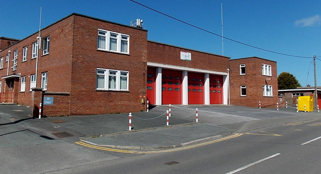
Image: © Jaggery Taken: 18 Apr 2014
Located on Merlin's Hill, Haverfordwest Fire Station is the Pembrokeshire Command Headquarters of the Mid and West Wales Fire and Rescue Service. The station covers the town of Haverfordwest and a large surrounding area including Johnston, Newgale, Letterston, and the A40 as far as Canaston Bridge.
Images are licensed for reuse under creativecommons.org/licenses/by-sa/2.0
Image Location
Latitude
51.796294
Longitude
-4.976033