Bourne End station, 1989
Introduction
The photograph on this page of Bourne End station, 1989 by Ben Brooksbank as part of the Geograph project.
The Geograph project started in 2005 with the aim of publishing, organising and preserving representative images for every square kilometre of Great Britain, Ireland and the Isle of Man.

There are currently over 7.5m images from over 14,400 individuals and you can help contribute to the project by visiting https://www.geograph.org.uk
Bourne End station, 1989
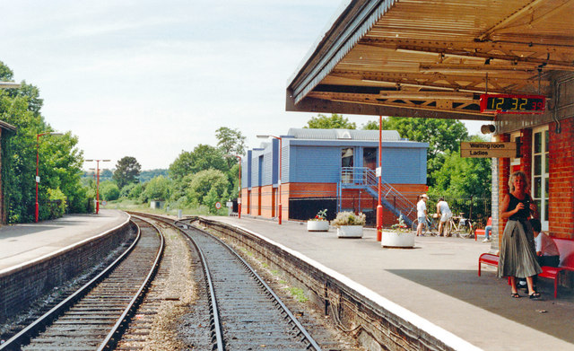
Image: © Ben Brooksbank Taken: 18 Jun 1989
View SW, towards Maidenhead (to left), Marlow (to right): ex-GWR Maidenhead - High Wycombe line, junction of branch to Marlow. From 4/5/70 the line on to High Wycombe was closed and the Marlow trains, now DMUs, from Maidenhead have reversed here. (My wife on right). [What is the rectangular building?]
Images are licensed for reuse under creativecommons.org/licenses/by-sa/2.0
Image Location
Latitude
51.576939
Longitude
-0.710709