Shelter on Filey Road
Introduction
The photograph on this page of Shelter on Filey Road by Christopher Hall as part of the Geograph project.
The Geograph project started in 2005 with the aim of publishing, organising and preserving representative images for every square kilometre of Great Britain, Ireland and the Isle of Man.

There are currently over 7.5m images from over 14,400 individuals and you can help contribute to the project by visiting https://www.geograph.org.uk
Shelter on Filey Road
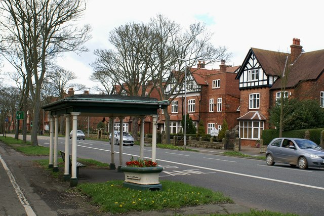
Image: © Christopher Hall Taken: 8 Apr 2014
This is one of two identical open shelters on the south cliff which consist of cast iron columns supporting a flat roof. It dates from the early 20th century but its reason for being here is unknown since it must pre-date bus services and there was no street tram up here. There is a detailed view of the horse trough in Image
Images are licensed for reuse under creativecommons.org/licenses/by-sa/2.0
Image Location
Latitude
54.267748
Longitude
-0.399104