Lots of markers
Introduction
The photograph on this page of Lots of markers by Neil Owen as part of the Geograph project.
The Geograph project started in 2005 with the aim of publishing, organising and preserving representative images for every square kilometre of Great Britain, Ireland and the Isle of Man.

There are currently over 7.5m images from over 14,400 individuals and you can help contribute to the project by visiting https://www.geograph.org.uk
Lots of markers
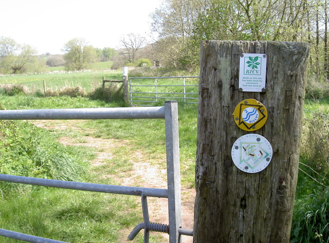
Image: © Neil Owen Taken: 16 Apr 2014
The amount of different organisations that are involved with the use of public footpaths is bigger than you might imagine. This set points to a path that runs north from Culverhay Bridge and crosses the old Wansdyke - an ancient ditch feature that starts at Maes Knoll fort and reaches east to Stantonbury Hill locally, before sweeping across the counties.
Images are licensed for reuse under creativecommons.org/licenses/by-sa/2.0
Image Location


Leaflet Map data © OpenStreetMap
Latitude
51.380245
Longitude
-2.508455