The upper reaches of the Flurry Valley
Introduction
The photograph on this page of The upper reaches of the Flurry Valley by Eric Jones as part of the Geograph project.
The Geograph project started in 2005 with the aim of publishing, organising and preserving representative images for every square kilometre of Great Britain, Ireland and the Isle of Man.

There are currently over 7.5m images from over 14,400 individuals and you can help contribute to the project by visiting https://www.geograph.org.uk
The upper reaches of the Flurry Valley
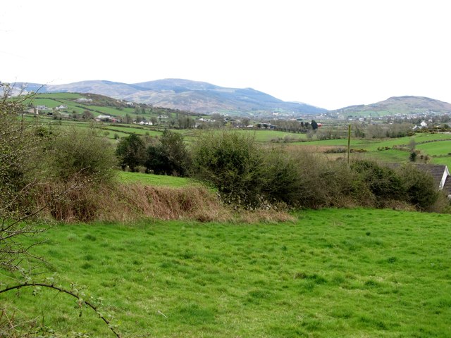
Image: © Eric Jones Taken: 11 Apr 2014
This image taken in a southerly direction shows the upper reaches of the Flurry Valley. In the background beyond the village of Meigh are the northern flank of the Cooley Mountains and on the right Faughill Mountain, the site of a large British Army fortress and observation base commanding the road and rail corridor to and from the South. Image
Images are licensed for reuse under creativecommons.org/licenses/by-sa/2.0
Image Location
Latitude
54.146811
Longitude
-6.402752