Selston, from Underwood: aerial 2014
Introduction
The photograph on this page of Selston, from Underwood: aerial 2014 by Chris as part of the Geograph project.
The Geograph project started in 2005 with the aim of publishing, organising and preserving representative images for every square kilometre of Great Britain, Ireland and the Isle of Man.

There are currently over 7.5m images from over 14,400 individuals and you can help contribute to the project by visiting https://www.geograph.org.uk
Selston, from Underwood: aerial 2014
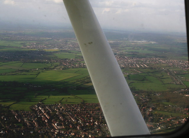
Image: © Chris Taken: 9 Apr 2014
Looking northwards. Taken from the wrong side of the aeroplane, but still worth a look, this shows the array of small former mining communities west of the M1 (which can be seen in the top right quarter, running diagonally upwards and to the left). Underwood at the bottom, then Selston and Pinxton. Underwood Community Centre and Recreation Ground bottom right.
Images are licensed for reuse under creativecommons.org/licenses/by-sa/2.0
Image Location
Latitude
53.073858
Longitude
-1.295901