Conval Street
Introduction
The photograph on this page of Conval Street by Anne Burgess as part of the Geograph project.
The Geograph project started in 2005 with the aim of publishing, organising and preserving representative images for every square kilometre of Great Britain, Ireland and the Isle of Man.

There are currently over 7.5m images from over 14,400 individuals and you can help contribute to the project by visiting https://www.geograph.org.uk
Conval Street
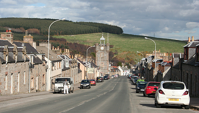
Image: © Anne Burgess Taken: 10 Apr 2014
Looking down Conval Street towards the Clock Tower, below which the street continues as Fife Street. The wide straight street with houses parallel to the street is typical of planned towns of the late eighteenth and early nineteenth centuries.
Images are licensed for reuse under creativecommons.org/licenses/by-sa/2.0
Image Location
Latitude
57.444512
Longitude
-3.131072