The site of St Botolph's church
Introduction
The photograph on this page of The site of St Botolph's church by Evelyn Simak as part of the Geograph project.
The Geograph project started in 2005 with the aim of publishing, organising and preserving representative images for every square kilometre of Great Britain, Ireland and the Isle of Man.

There are currently over 7.5m images from over 14,400 individuals and you can help contribute to the project by visiting https://www.geograph.org.uk
The site of St Botolph's church
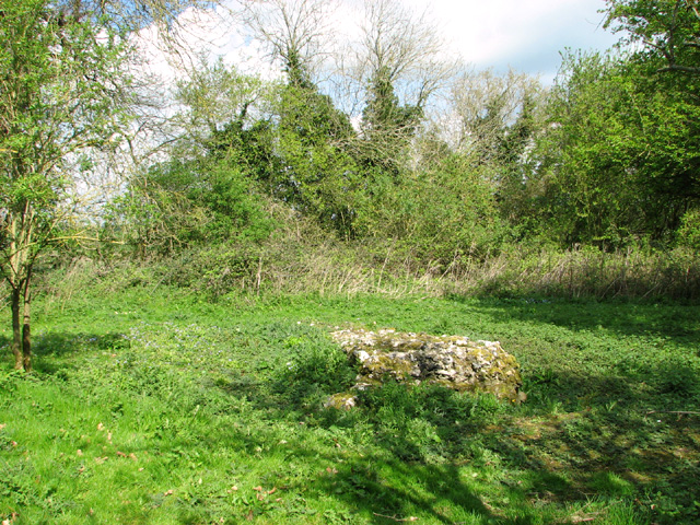
Image: © Evelyn Simak Taken: 11 Apr 2014
This is the site of St Botolph’s church which was destroyed during the Reformation. In 1965 a number of medieval and post medieval pottery sherds were recovered from here but in 1976 only a few overgrown humps remained and until recently the whole site was covered in thick undergrowth until in 2013 the site was cleared and made accessible. Only a small part of the west wall of the square tower and possible evidence of a buttress remain. A bench was put up at the far end of the site > http://www.geograph.org.uk/photo/3925311. The other three churches in the parish are St Mary's http://www.geograph.org.uk/photo/1372461 which is only a short distance away from the ruined church of St Martin > http://www.geograph.org.uk/photo/1372643 also recently cleared of vegetation, and All Saints > http://www.geograph.org.uk/photo/1371795.
Images are licensed for reuse under creativecommons.org/licenses/by-sa/2.0
Image Location
Latitude
52.54564
Longitude
1.301422