Approaching Heaton Park Tunnel
Introduction
The photograph on this page of Approaching Heaton Park Tunnel by David Dixon as part of the Geograph project.
The Geograph project started in 2005 with the aim of publishing, organising and preserving representative images for every square kilometre of Great Britain, Ireland and the Isle of Man.

There are currently over 7.5m images from over 14,400 individuals and you can help contribute to the project by visiting https://www.geograph.org.uk
Approaching Heaton Park Tunnel
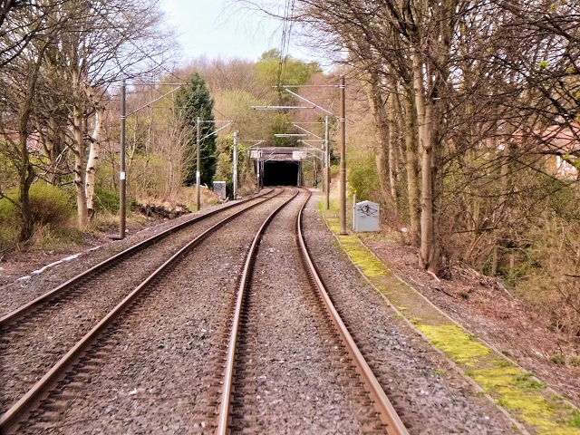
Image: © David Dixon Taken: 8 Apr 2014
The southern approach to the tunnel under Heaton Park. The Heaton Park Tunnel was constructed during the 19th century when the Lancashire and Yorkshire Railway’s line between Manchester and Radcliffe was being laid. Lord Wilton, the owner of the estate at that time, was not prepared to see his estate disfigured by a railway and insisted on the trains going under his estate and not in a cutting. Although known as Heaton Park Tunnel it should, perhaps, be more correctly described as a covered way as it was not constructed by tunnelling but was dug out and then roofed over. It is possibly the shallowest railway tunnel in the UK. At one point, the top of the brick arch is less than two feet underground. The 713-yards tunnel and a railway station (now Heaton Park Metrolink station) adjacent to the park’s Whittaker Lane/Bury Old Road entrance were opened in 1879.
Images are licensed for reuse under creativecommons.org/licenses/by-sa/2.0
Image Location
Latitude
53.52708
Longitude
-2.255045