Linton Park seen across its park
Introduction
The photograph on this page of Linton Park seen across its park by Marathon as part of the Geograph project.
The Geograph project started in 2005 with the aim of publishing, organising and preserving representative images for every square kilometre of Great Britain, Ireland and the Isle of Man.

There are currently over 7.5m images from over 14,400 individuals and you can help contribute to the project by visiting https://www.geograph.org.uk
Linton Park seen across its park
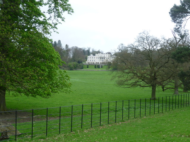
Image: © Marathon Taken: 6 Apr 2014
In the 1730s Robert Mann built a house which was two-storeyed on the north side and three-storeyed on this (south) side. Horace Walpole described it at the time as "like the citadel of Kent with the whole county as its garden". Shortly before 1829 a third storey was added by Thomas Cubitt and a balustraded terrace was added to the south front. The whole was then stuccoed and painted white. Pevsner describes it: "The effect is as if a section of Carlton House Terrace has been transferred to the hills." Here it is seen across its park from a footpath. For more information on the history of the house see D Gore's write up at http://www.geograph.org.uk/photo/893507
Images are licensed for reuse under creativecommons.org/licenses/by-sa/2.0
Image Location
Latitude
51.221586
Longitude
0.516086