Northway, Scarborough
Introduction
The photograph on this page of Northway, Scarborough by Christopher Hall as part of the Geograph project.
The Geograph project started in 2005 with the aim of publishing, organising and preserving representative images for every square kilometre of Great Britain, Ireland and the Isle of Man.

There are currently over 7.5m images from over 14,400 individuals and you can help contribute to the project by visiting https://www.geograph.org.uk
Northway, Scarborough
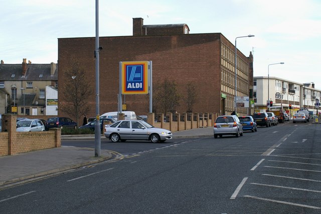
Image: © Christopher Hall Taken: 10 Jan 2014
The street called Northway was created in the 1930s in order to improve traffic links from the South cliff area, across Valley Bridge, to the north side. Demolition started in 1930 and at this point Albion Street was removed completely. The large brick building was built by the Ministry of Works in the 1950s. The Aldi sign and car park are on the site of the former West Yorkshire Road Car Company bus station and garage, built in 1939. After going out of use it became a motor dealership but was subsequently demolished to make way for the Aldi car park. The 'shadow' of the bus station building can be seen on the end wall of the 1950s building.
Images are licensed for reuse under creativecommons.org/licenses/by-sa/2.0
Image Location
Latitude
54.281518
Longitude
-0.407172