Conduit for the Lusset Burn
Introduction
The photograph on this page of Conduit for the Lusset Burn by Lairich Rig as part of the Geograph project.
The Geograph project started in 2005 with the aim of publishing, organising and preserving representative images for every square kilometre of Great Britain, Ireland and the Isle of Man.

There are currently over 7.5m images from over 14,400 individuals and you can help contribute to the project by visiting https://www.geograph.org.uk
Conduit for the Lusset Burn
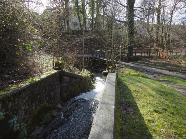
Image: © Lairich Rig Taken: 11 Mar 2014
The viewpoint is the same as for Image, namely, at the mouth of the tunnel, but the view is in almost the opposite direction. As the other picture shows, the tunnel contains, as well as a footpath, a conduit for the Dalnottar or Lusset Burn; from the mouth of the tunnel, the footpath continues straight ahead (south-west), but the conduit turns sharply to the south. For a view back to this point from the other side of the footbridge, see Image
Images are licensed for reuse under creativecommons.org/licenses/by-sa/2.0
Image Location
Latitude
55.922414
Longitude
-4.450866