Close up of Yalding Village Sign
Introduction
The photograph on this page of Close up of Yalding Village Sign by Marathon as part of the Geograph project.
The Geograph project started in 2005 with the aim of publishing, organising and preserving representative images for every square kilometre of Great Britain, Ireland and the Isle of Man.

There are currently over 7.5m images from over 14,400 individuals and you can help contribute to the project by visiting https://www.geograph.org.uk
Close up of Yalding Village Sign
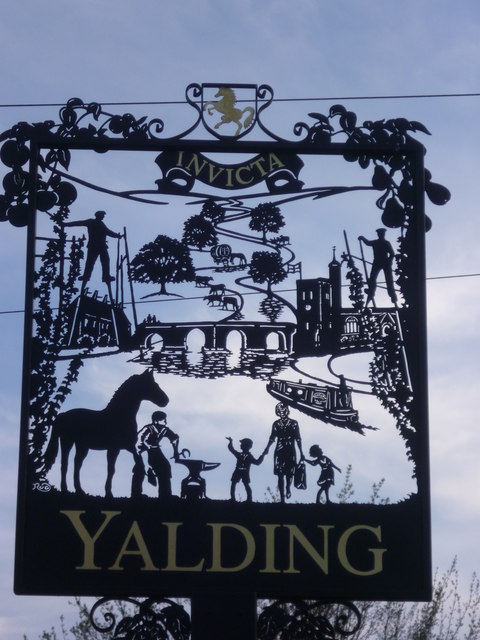
Image: © Marathon Taken: 1 Apr 2014
This very attractive new sign includes many of the features for which Yalding is well known. These include the medieval town bridge, the church, hop pickers, a gypsy caravan and cattle by the river, oast houses, a canal boat and a blacksmith, as well, of course, of the horse symbol of Kent at the top. A view of the sign on the other side can be seen at http://www.geograph.org.uk/photo/3164900 and the previous sign can be seen at http://www.geograph.org.uk/photo/1854525
Images are licensed for reuse under creativecommons.org/licenses/by-sa/2.0
Image Location
Latitude
51.22553
Longitude
0.431651