Bridge on Vicarage Lane
Introduction
The photograph on this page of Bridge on Vicarage Lane by David Anstiss as part of the Geograph project.
The Geograph project started in 2005 with the aim of publishing, organising and preserving representative images for every square kilometre of Great Britain, Ireland and the Isle of Man.

There are currently over 7.5m images from over 14,400 individuals and you can help contribute to the project by visiting https://www.geograph.org.uk
Bridge on Vicarage Lane
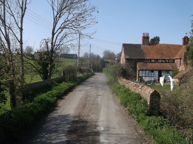
Image: © David Anstiss Taken: 29 Mar 2014
This lane leads from Whitehill down to Water Lane in Ospringe. The bridge passes over an old stream that used to flow from Whitehill through Ospringe, under the A2 (London Road) and through Faversham. It used to flood Ospringe several times a year until the M2 Motorway was built and a culvert was also built to divert the stream. Queens Court Farm is in the background.
Images are licensed for reuse under creativecommons.org/licenses/by-sa/2.0
Image Location
Latitude
51.307782
Longitude
0.870206