Rotherham - Don Street and Corporation Bridge
Introduction
The photograph on this page of Rotherham - Don Street and Corporation Bridge by Dave Bevis as part of the Geograph project.
The Geograph project started in 2005 with the aim of publishing, organising and preserving representative images for every square kilometre of Great Britain, Ireland and the Isle of Man.

There are currently over 7.5m images from over 14,400 individuals and you can help contribute to the project by visiting https://www.geograph.org.uk
Rotherham - Don Street and Corporation Bridge
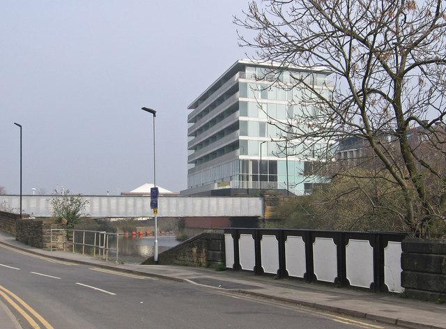
Image: © Dave Bevis Taken: 30 Mar 2014
For a more complete photo of Corporation Bridge, please see Image The black-and-white bridge parapet seen in the bottom right-hand quadrant of the photo is a bit of a puzzle. The design suggests that this Don Street bridge was built in the canal-building era. However, I am unsure whether it was an access to a wharf to the west of the Don Navigation or actually part of the Don Navigation prior to 1838. In 1838, the Don Navigation was diverted to make way for the building of the railway from Sheffield to Rotherham Westgate Station. The Wikipedia article at http://en.wikipedia.org/wiki/Rotherham_Westgate_railway_station provides a few clues but not a definitive answer.
Images are licensed for reuse under creativecommons.org/licenses/by-sa/2.0
Image Location
Latitude
53.429281
Longitude
-1.359576