Rolls Farmhouse, Tollesbury (listed building)
Introduction
The photograph on this page of Rolls Farmhouse, Tollesbury (listed building) by Roger Jones as part of the Geograph project.
The Geograph project started in 2005 with the aim of publishing, organising and preserving representative images for every square kilometre of Great Britain, Ireland and the Isle of Man.

There are currently over 7.5m images from over 14,400 individuals and you can help contribute to the project by visiting https://www.geograph.org.uk
Rolls Farmhouse, Tollesbury (listed building)
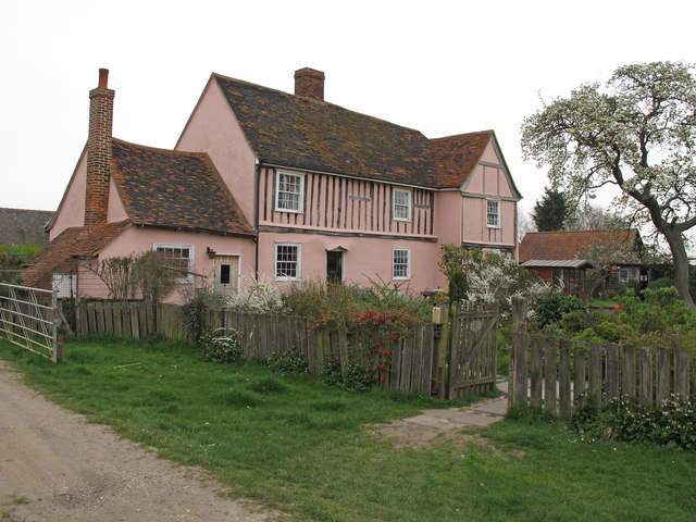
Image: © Roger Jones Taken: 30 Mar 2014
House. Mid-C16, timber framed, plastered with some exposed framing. Listed building entry Number: 1120903 http://list.english-heritage.org.uk/resultsingle.aspx?uid=1120903
Images are licensed for reuse under creativecommons.org/licenses/by-sa/2.0
Image Location
Latitude
51.741528
Longitude
0.81434