Jordanstown railway station (2014/1982 comparison)
Introduction
The photograph on this page of Jordanstown railway station (2014/1982 comparison) by Albert Bridge as part of the Geograph project.
The Geograph project started in 2005 with the aim of publishing, organising and preserving representative images for every square kilometre of Great Britain, Ireland and the Isle of Man.

There are currently over 7.5m images from over 14,400 individuals and you can help contribute to the project by visiting https://www.geograph.org.uk
Jordanstown railway station (2014/1982 comparison)
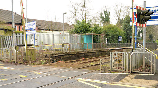
Image: © Albert Bridge Taken: 30 Mar 2014
The Greenisland end of Jordanstown station – the automatic full-barrier level crossing across the Jordanstown Road, relay box and a basic booking office. Image shows the same view in February 1982 when there was a brick station building and manually-operated level crossing gates. Given its proximity to the existing university campus Image the future development of the station will have to take account of the new one in Belfast http://www.geograph.org.uk/snippet/6801.
Images are licensed for reuse under creativecommons.org/licenses/by-sa/2.0
Image Location
Latitude
54.687374
Longitude
-5.894938