Boundary Marker, Redcliffe Road
Introduction
The photograph on this page of Boundary Marker, Redcliffe Road by Alan Murray-Rust as part of the Geograph project.
The Geograph project started in 2005 with the aim of publishing, organising and preserving representative images for every square kilometre of Great Britain, Ireland and the Isle of Man.

There are currently over 7.5m images from over 14,400 individuals and you can help contribute to the project by visiting https://www.geograph.org.uk
Boundary Marker, Redcliffe Road
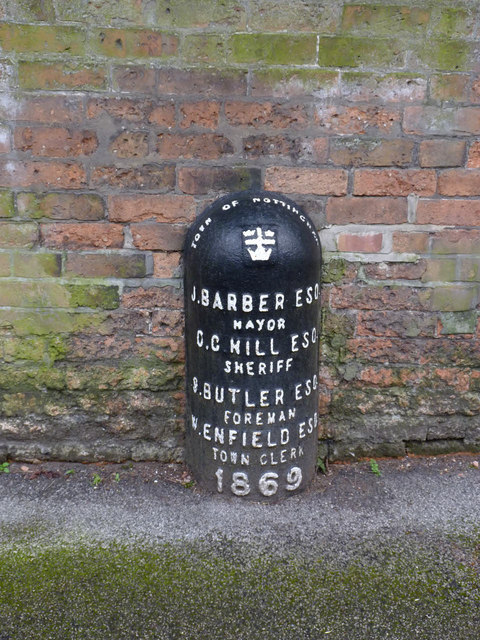
Image: © Alan Murray-Rust Taken: 18 Mar 2014
In 1869 this was still the municipal boundary. The marker is one of a number erected in connection with Poor Law area boundaries. Listed Grade II. See http://www.geograph.org.uk/photo/3903439 for location.
Images are licensed for reuse under creativecommons.org/licenses/by-sa/2.0
Image Location
Latitude
52.969249
Longitude
-1.1487