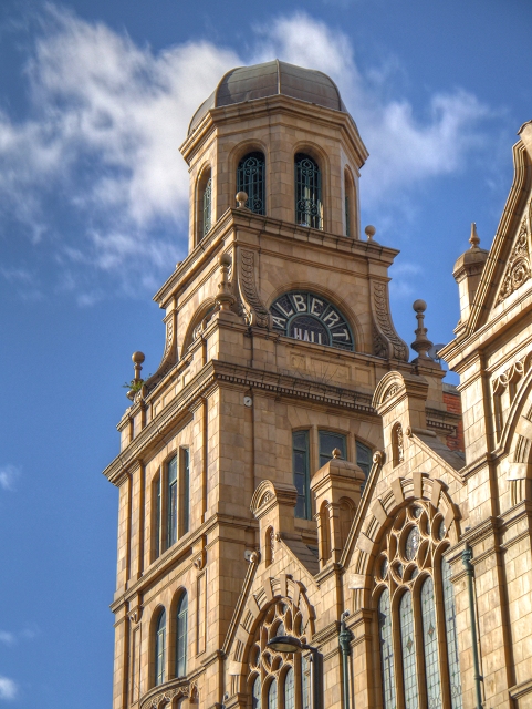
Albert Hall, Manchester
Introduction
The photograph on this page of Albert Hall, Manchester by David Dixon as part of the Geograph project.
The Geograph project started in 2005 with the aim of publishing, organising and preserving representative images for every square kilometre of Great Britain, Ireland and the Isle of Man.
There are currently over 7.5m images from over 14,400 individuals and you can help contribute to the project by visiting https://www.geograph.org.uk

Image: © David Dixon Taken: 23 Mar 2014
The Albert Hall, on Peter Street, is a Grade II listed building (English Heritage ID:455644 http://www.britishlistedbuildings.co.uk/en-455644-albert-memorial-hall- British Listed Buildings). It was designed, with a mixture of Baroque and Gothic elements, by the architect WJ Morley and built in 1910 as the Manchester and Salford Wesleyan Mission. Albert Hall as a Methodist meeting place is now closed. The lower two floors were converted to Brannigans, a large and, for a period of time, popular bar and nightclub during the 1990s. Brannigans closed in 2011, and the recently refurbished building reopened in 2014 as an events venue, restaurant and bar. According to their website http://www.alberthallmanchester.com/information.php , “The grand and ornate chapel has been restored into a stunning purpose built music hall and is set to become one of the most atmospheric music and events venues in the UK.” see also Image] and Image] http://manchesterhistory.net/manchester/tours/tour6/alberthall.html Manchester History Net
Image Location


