Marple - towpath access at Church Lane
Introduction
The photograph on this page of Marple - towpath access at Church Lane by Dave Bevis as part of the Geograph project.
The Geograph project started in 2005 with the aim of publishing, organising and preserving representative images for every square kilometre of Great Britain, Ireland and the Isle of Man.

There are currently over 7.5m images from over 14,400 individuals and you can help contribute to the project by visiting https://www.geograph.org.uk
Marple - towpath access at Church Lane
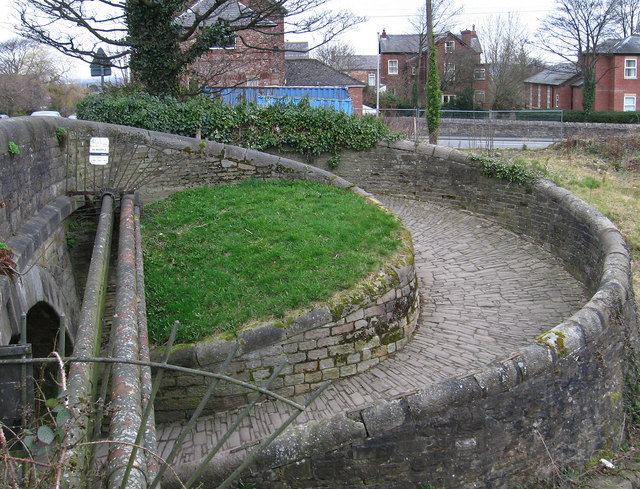
Image: © Dave Bevis Taken: 15 Mar 2014
This provides access on to the Macclesfield Canal. For an alternative view and for an explanation of the spiral design of the towpath access, please see Image
Images are licensed for reuse under creativecommons.org/licenses/by-sa/2.0
Image Location


Leaflet Map data © OpenStreetMap
Latitude
53.39179
Longitude
-2.061311