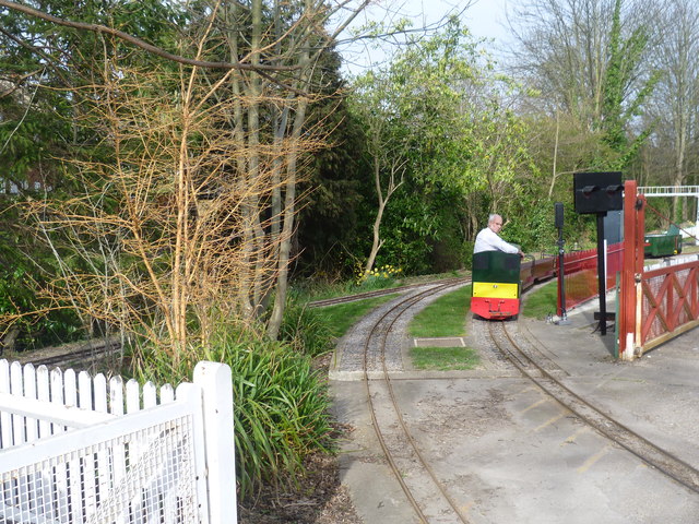
The Thames Ditton Miniature Railway
Introduction
The photograph on this page of The Thames Ditton Miniature Railway by Marathon as part of the Geograph project.
The Geograph project started in 2005 with the aim of publishing, organising and preserving representative images for every square kilometre of Great Britain, Ireland and the Isle of Man.
There are currently over 7.5m images from over 14,400 individuals and you can help contribute to the project by visiting https://www.geograph.org.uk

Image: © Marathon Taken: 19 Mar 2014
The Thames Ditton Miniature Railway is run by The Malden and District Society of Model Engineers. The Society were founded in 1936 and ran a portable model railway track that was often set up for fetes etc in the area around New Malden. The society started to build its first railway in Beverley Park New Malden which was known as the Beverley Park Miniature Railway. After the Second World War the Society decided to find a site upon which to erect a permanent raised track along with a clubhouse. In 1948, the Society was offered a long term lease on the present site at Thames Ditton by the Macey Family Trust. The group then set about creating the Thames Ditton Miniature Railway which is what is seen here. The Society has full and interesting web sites, including this http://malden-dsme.co.uk/public/aboutus.html and an even fuller history at http://malden-dsme.co.uk/public/history.html Their site is easily missed in what looks like a small industrial estate off Claygate Lane between Portsmouth Road (A307) and the railway bridges across Claygate Lane. It can be spotted from Waterloo-bound trains between Thames Ditton and Surbiton. Details of open days are here - http://malden-dsme.co.uk/public/opendays.html This photograph was taken from the footbridge seen on the right here - http://www.geograph.org.uk/photo/3893726 It was not an open day as the season did not start until Easter.

