Ogden Lane, Rastrick
Introduction
The photograph on this page of Ogden Lane, Rastrick by Humphrey Bolton as part of the Geograph project.
The Geograph project started in 2005 with the aim of publishing, organising and preserving representative images for every square kilometre of Great Britain, Ireland and the Isle of Man.

There are currently over 7.5m images from over 14,400 individuals and you can help contribute to the project by visiting https://www.geograph.org.uk
Ogden Lane, Rastrick
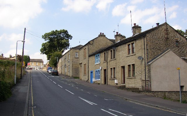
Image: © Humphrey Bolton Taken: 17 Aug 2005
This is part of the old main road up through Rastrick. It was turnpiked in the early 19C, and was the A643 until the mid-20C when the parallel road to the W received that dubious honour. The photo was taken from the junction with Toothill Bank at the foot of the hill. The building to the right of the parked vehicles is the former Rastrick lock-up, the window of which is still just visible at pavement level.
Images are licensed for reuse under creativecommons.org/licenses/by-sa/2.0
Image Location
Latitude
53.690664
Longitude
-1.789473