Aerial view of Islip, Oxfordshire
Introduction
The photograph on this page of Aerial view of Islip, Oxfordshire by Dave Price as part of the Geograph project.
The Geograph project started in 2005 with the aim of publishing, organising and preserving representative images for every square kilometre of Great Britain, Ireland and the Isle of Man.

There are currently over 7.5m images from over 14,400 individuals and you can help contribute to the project by visiting https://www.geograph.org.uk
Aerial view of Islip, Oxfordshire
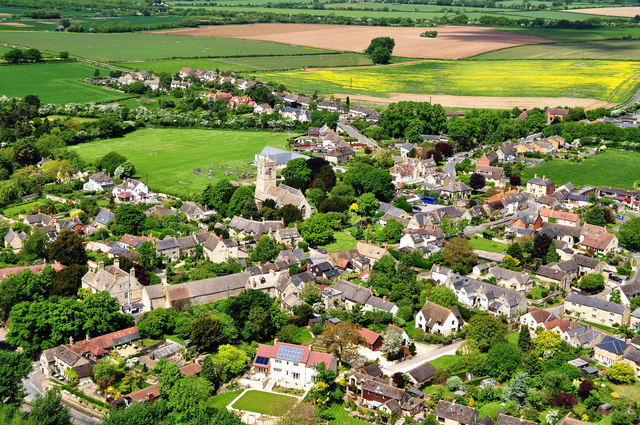
Image: © Dave Price Taken: 2 Jun 2013
Taken from the South-East, the Red Lion Pub is lower left, and St Nicholas' Church in the centre of the photo with children's playground and playing field lying behind.
Images are licensed for reuse under creativecommons.org/licenses/by-sa/2.0
Image Location
Latitude
51.822683
Longitude
-1.236347