Greenhead: northward beside site/remains of station, 1997
Introduction
The photograph on this page of Greenhead: northward beside site/remains of station, 1997 by Ben Brooksbank as part of the Geograph project.
The Geograph project started in 2005 with the aim of publishing, organising and preserving representative images for every square kilometre of Great Britain, Ireland and the Isle of Man.

There are currently over 7.5m images from over 14,400 individuals and you can help contribute to the project by visiting https://www.geograph.org.uk
Greenhead: northward beside site/remains of station, 1997
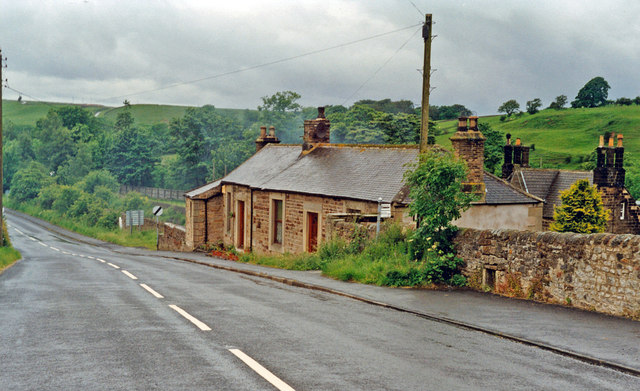
Image: © Ben Brooksbank Taken: 26 Jun 1997
View northward on B6318 to Gilsland, towards the summit of the ex-NER Newcastle - Carlisle main line, see Image This is the head of the valley of the River South Tyne and close to the border between Northumberland and Cumberland: the course of Hadrian's Wall is along the bank on the right.
Images are licensed for reuse under creativecommons.org/licenses/by-sa/2.0
Image Location
Latitude
54.982384
Longitude
-2.534516