Welcome to Penrhiwceiber banner
Introduction
The photograph on this page of Welcome to Penrhiwceiber banner by Jaggery as part of the Geograph project.
The Geograph project started in 2005 with the aim of publishing, organising and preserving representative images for every square kilometre of Great Britain, Ireland and the Isle of Man.

There are currently over 7.5m images from over 14,400 individuals and you can help contribute to the project by visiting https://www.geograph.org.uk
Welcome to Penrhiwceiber banner
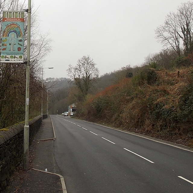
Image: © Jaggery Taken: 30 Jan 2014
Located alongside the B4275 Abercynon Road at the SE edge of the village. It is facing the wrong way, towards drivers and walkers leaving Penrhiwceiber on the road to Abercynon. The explanation is a mixture of geography and bilingualism. The bank on the opposite side of the road leaves no room for a sign there. On the back on this sign is one in Welsh, http://www.geograph.org.uk/photo/3891455 facing those entering the village. The depiction on the banner is titled Eat a Rainbow. The rainbow in question is a variety of variously coloured fruit and vegetables. The banner was designed by the Learning Observation Class at Penrhiwceiber Primary School.
Images are licensed for reuse under creativecommons.org/licenses/by-sa/2.0
Image Location
Latitude
51.664702
Longitude
-3.360221