Camp moat
Introduction
The photograph on this page of Camp moat by Neil Owen as part of the Geograph project.
The Geograph project started in 2005 with the aim of publishing, organising and preserving representative images for every square kilometre of Great Britain, Ireland and the Isle of Man.

There are currently over 7.5m images from over 14,400 individuals and you can help contribute to the project by visiting https://www.geograph.org.uk
Camp moat
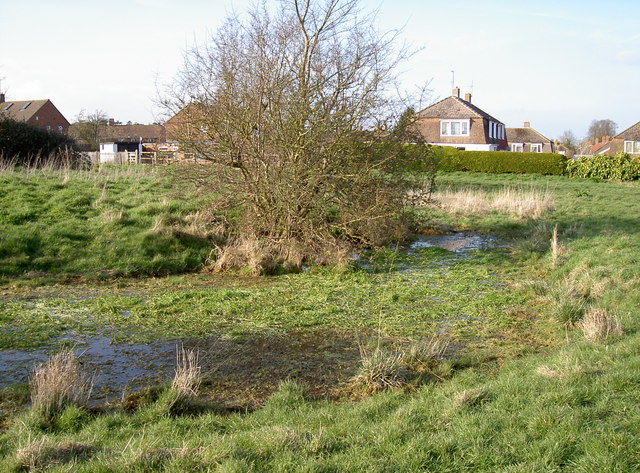
Image: © Neil Owen Taken: 10 Mar 2014
The remnants of the old earthworks have softened over the years but the recent flooding has left a fair amount of water in the bottom of the ditches. It lends some effect of what it perhaps used to look like. Many eminent historians have puzzled over Margaret's Camp, but few believe it was originally part of the Battle of Tewkesbury of 1471. A fairly popular theory relates that this small moated area was part of some older manor house or farmstead. There are some straighter ditches to the west and it's thought they concern water management - something that would be necessary in this low-lying part of Gloucestershire near the River Severn! See Image] for another view.
Images are licensed for reuse under creativecommons.org/licenses/by-sa/2.0
Image Location
Latitude
51.98114
Longitude
-2.153853