Housing and chimneys by Park Brewery, Wolverhampton
Introduction
The photograph on this page of Housing and chimneys by Park Brewery, Wolverhampton by Roger D Kidd as part of the Geograph project.
The Geograph project started in 2005 with the aim of publishing, organising and preserving representative images for every square kilometre of Great Britain, Ireland and the Isle of Man.

There are currently over 7.5m images from over 14,400 individuals and you can help contribute to the project by visiting https://www.geograph.org.uk
Housing and chimneys by Park Brewery, Wolverhampton
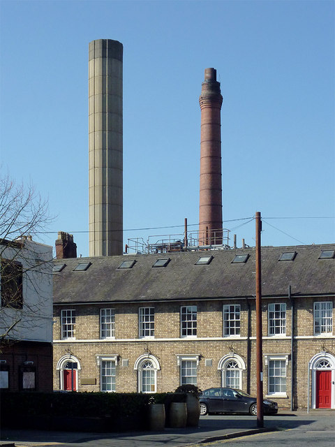
Image: © Roger D Kidd Taken: 9 Mar 2014
This is Brewery Road (formerly Lovatt Street, and before that, Clarence Place) seen from Brewery Road (formerly Albany Road). The Park Brewery (established in 1875) brews Banks's beer, but trades under the name of Marston's since it re-branded in 2007 following purchase of Marston's brewery (Burton-on-Trent) in 1999. The houses were built in about 1840, and are now used as offices, and are locally listed buildings. The chimneys are part of the brewery.
Images are licensed for reuse under creativecommons.org/licenses/by-sa/2.0
Image Location
Latitude
52.585306
Longitude
-2.137809